| Lampy's Pierre SD River Watch Page |
NOAA Hydrograph Hwy 14-34 Bridge Pierre SD
|
NOAA Hydrograph Lake Oahe Pool Level Pierre SD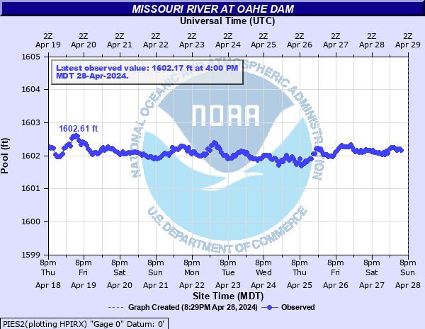
|
NOAA Hydrograph La Framboise Island Pierre SD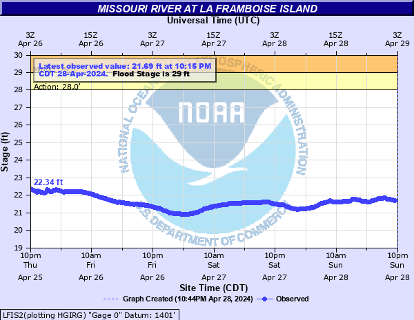
|
NOAA Hydrograph Farm Island Pierre SD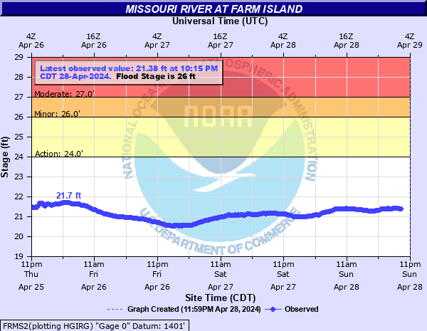
|
Other Links
Corp Missouri River Dam Engineering Summary
Corp Missouri River Dam Elevation Summary
Corp Missouri River Basin Water Mgmt Info
Fairway Drive Photo Album1 2011
Fairway Drive Photo Album2 2011
Fairway Drive SDPB Interview Stewarts 2011
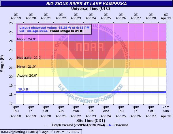
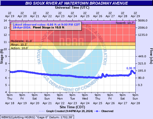
Some Big Sioux River Gauges
Lake Kampeska at Big Sioux River
| Lampy's Pierre SD River Watch Page |
NOAA Hydrograph Hwy 14-34 Bridge Pierre SD
|
NOAA Hydrograph Lake Oahe Pool Level Pierre SD
|
NOAA Hydrograph La Framboise Island Pierre SD
|
NOAA Hydrograph Farm Island Pierre SD
|
Some Other Links
Corp Missouri River Basin – Weekly Update
Missouri System Storage 2011 Vs 2022-23
Corp Missouri Basin Information
NOAA River level chart Hwy 14-34 Bridge
NOAA Lake Oahe Pool Level
USGS River Gauge Hwy 14-34 Bridge
USGS River Gauge LaFrambois Island
USGS River Gauge Farm Island
USGS Bad River flow Ft Pierre
NWS Aberdeen Precipitation Map
Corp GARRISON production orders
Corp OAHE production orders
Corp Big Bend production orders
Corp Ft Randall production orders
Corp Gavins Pt production orders
NOAA Upper Missouri River Flows
Missouri River Basin Water Management Data